Road to Ojos del Salado
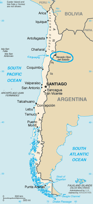
Figure 1.: Location of Ojos del Salado relative to Copiapó
and Santiago of Chile.
Ojos del Salado is located at 27.1101°S,
68.5416°W and has an elevation of 6900 meters (22638
feet). It is the second highest mountain in the Andes (the third
highest in the world outside the Himalaya) after
Mount Aconcagua and the highest active volcano on Earth. Ojos
del Salado is about 295 km North-East from Copiapó, while the
latter is located about 800 km north of Santiago, the
capital of Chile (see Figure 1).
In this expedition, we followed an acclimatization program
that included the setting of 5 camps before the attack to the
summit (see Figure
2). From Santiago, we went to Copiapó by bus, traveling 800 km in about 10
hours. From Copiapó, we set off to camp No. 1, at about
3100 meters, in a place called Vallecito
(see Figure 2).
This one would be our first point for acclimatization. The
second place of the program was Laguna Santa Rosa,
at about 3700 meters, where we set camp No. 2 (see Figure 2). Here,
as part of the acclimatization, we did treks around the lagoon
and to a couple of nearby mountains: Cerro Siete Hermanas (4877
meters) and Cerro Santa Rosa (4911 meters).
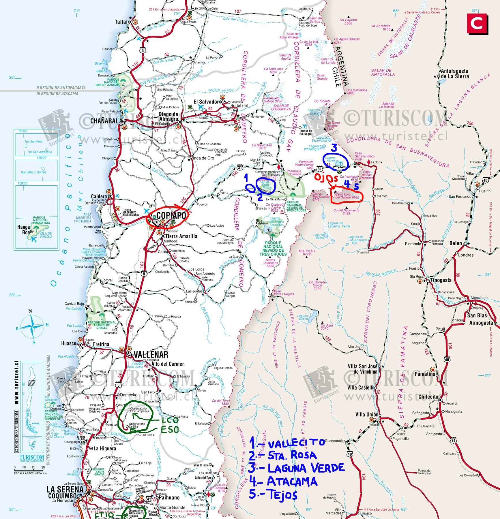
Figure 2.: Camp sites (in blue) of this expedition.
From Laguna Santa Rosa, we moved on to our next camp (camp No. 3) site: Laguna Verde at about 4300 meters (see Figure 2). This place is the entrance to the Ojos del Salado Zone, and it is where all IDs/passports and climbing permits are checked by the federal police. The nearby Cerro Mirador Mulas Muertas (5500 meters) is used as part of the acclimatization work: we all reached the 5100 meters mark on this mountain. Next point is camp No. 4 at 5300 meters (see Figure 2), right on Ojos del Salado itself. This camp, named Atacama (see Figure 3), is the base camp for the final climb. From here, all the gear needed for the summit attempt, is carried in a 3 hours hike to the last camp (camp No. 5), named Tejos, at about 5800 meters (see Figure 3). From Tejos, the final climb to the top involves the progression on sandy terrain, with a snow field crossing, above 6100 meters.
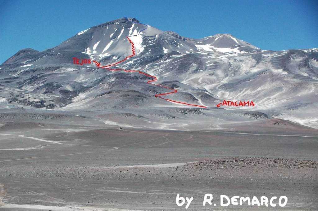
Figure 3.: Final route to the summit from Atacama base camp.
Figure 3 shows the path to the summit of Ojos del Salado from the Atacama base camp: the way climbed by us is shown in red and what remained to be climbed in this expedition is shown in blue.
 Back to main
Ricardo Demarco - Last update: 12 February 2006

