
HOW TO GET TO THE ASTRONOMY BUILDING:
The building of the Astronomy Department (Fig. 1) of the
Universidad de Concepción (UdeC) is located on its
main campus in Concepción, next to the so-called
"Laguna de
Los Patos". You may ask about this place if you get lost on
campus. In principle, almost anybody should know where it
is. The main entrance of the campus is located on Chacabuco
1363, at the so-called "Arco de Medicina". This arch (Fig. 2) is
an icon of the city; you cannot miss it! After entering campus
through the arch, walk straight until you reach another city's
landmark: "El Campanil". The Laguna de Los Patos
and the Astronomy Department's
building are located to the left of this clock tower
(Fig. 3) when walking from the main entrance. It takes about 1
minute to reach the building from the clock tower. In case of
doubt, you may ask. The exact location of the building is
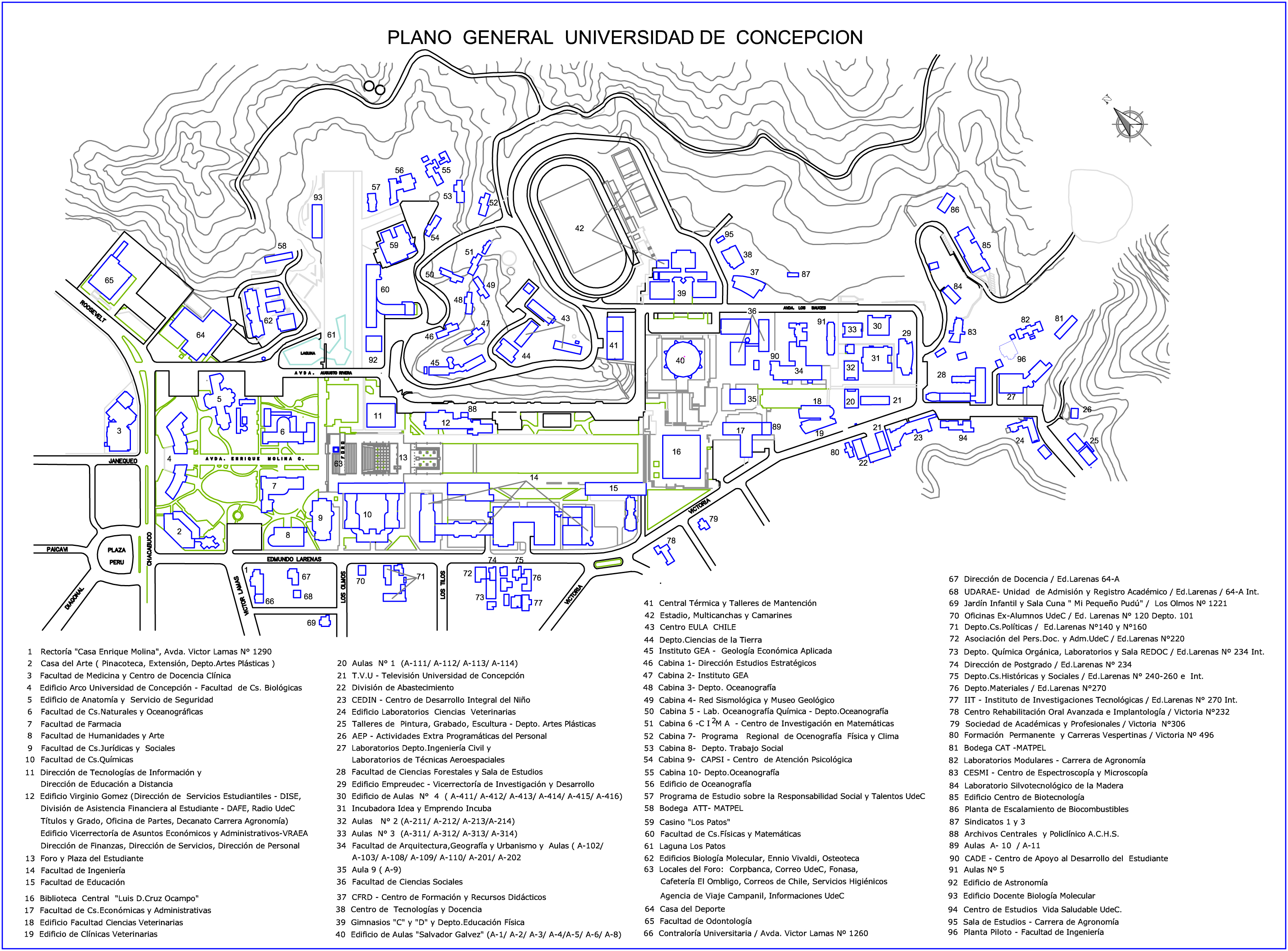
at No.
92 on this campus map (main entrance at No. 4).
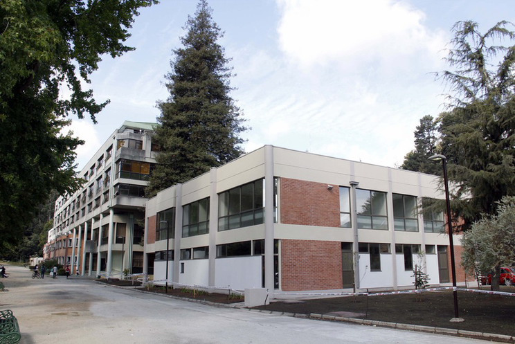
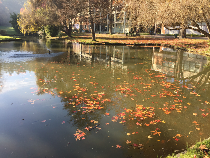
Fig 1: the astronomy building as seen when walking from
the Campanil (Fig.3). The Laguna Los Patos is
to the left (outside the photograph). |
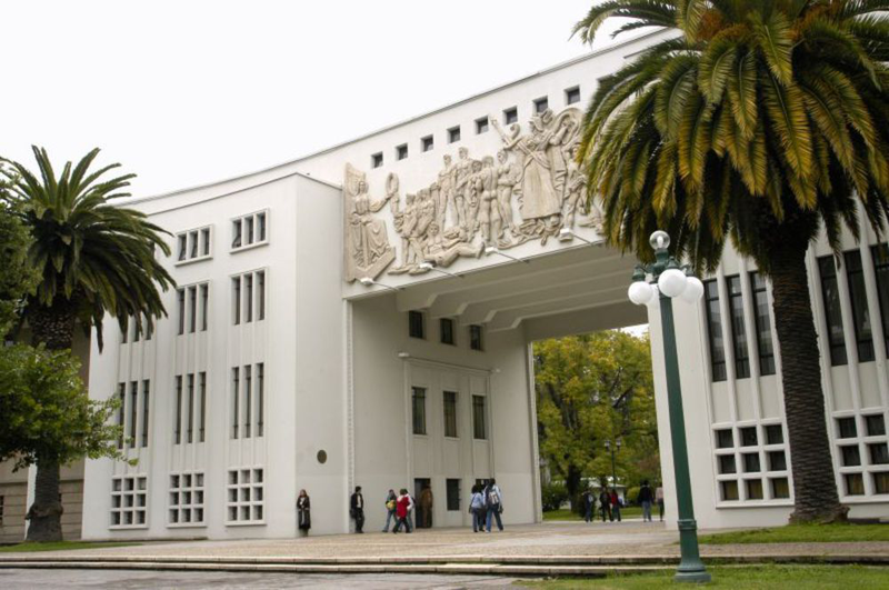
Fig 2: the university's main entrance:
the arch on Chacabuco Ave. |
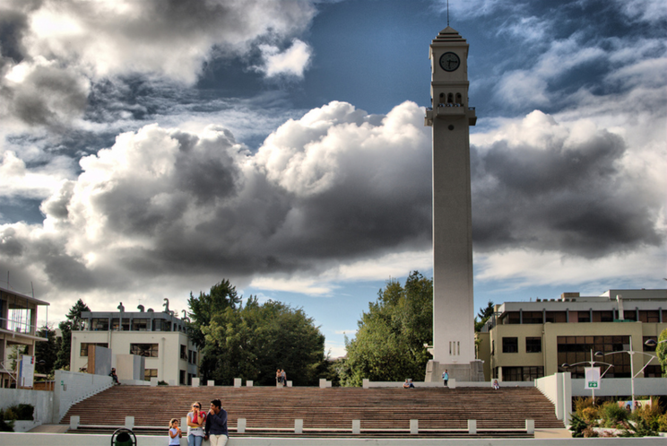
Fig 3: the Campanil on campus. In this picture, the
university's main entrance is behind the clock tower and
the astronomy building is to the right. |
If you are coming from within the city, it is very easy to
get to the university by public transport. Perhaps the
easiest way is to get in a "colectivo". These are shared
taxi cabs, with numbers on top, that follow a pre-defined
rout and are really cheap compared to regular taxis. There
are several lines that run on Chacabuco and will get you to
the main entrance. Some of them are: 4, 10, 16. Other
options are buses, regular taxi cabs, and Uber. Of course, you
can also walk to Campus. For example, if you are at the Plaza de
La Independencia (the main square in downtown), you can walk on
O'Higgins to the North-East, then take Diagonal Pedro Aguirre
Cerda to the South-East until you reach Plaza Perú. From
here, you can walk on Av. Chacabuco about 100 meters to the
North-East to reach the Arco de Medicina.
If you are coming from outside Concepción you should
first get to the city. This can be done by air or by land.
• Getting to Concepción by air:
the nearest airport is "Carriel Sur" airport located in
the nearby Talcahuano. Its IATA location code is
CCP. Pretty much all the commercial flights to this
airport are from Santiago. Once you exit the airport, it
should be a 25-minute drive to campus (see Fig. 4 for
possible routes). You can take some of the taxis or
transfer vans located by the curve or call an Uber (please
note that you will have to practice your Spanish. The
University is a very well known place in town: just
indicate that you are going there).
• Getting to Concepción by land:
the main freeway that goes to the city is "Ruta del Itata"
(Route 152; Fig. 5). This one can be accessed from "Ruta 5 South"
(the Panamerican Highway shouth of Santiago) by the city
of Chillán (just follow the signs). Another freeway
that branches off from Ruta 5 South by the town of Cabrero
(further south from Chillán) and that goes to
Concepción is the so-called "Ruta Cabrero". Keep in
mind that you will have to pay tolls along the way on all
the above freeways if you are driving. There are several
bus companies that go from Santiago to
Concepción. All of these will take Ruta del Itata
and will make a stop at the main bus terminal in
Concepción: "Terminal Collao". You should get off
here and take public transportation to Campus (Fig. 6
shows possible routes; see also above for public
transportation). You could also walk from Collao to campus
but that would take some 45 minutes.
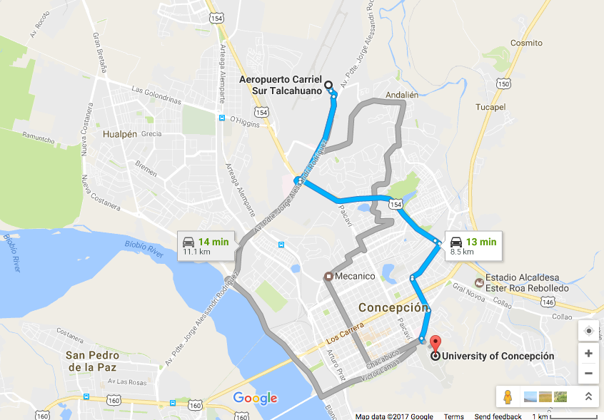
Fig 4: the way from Carriel Sur airport to the University of
Concepción main campus. |
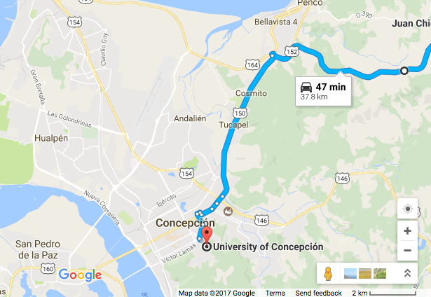
Fig 5: the way to Concepción via Ruta del
Itata. |
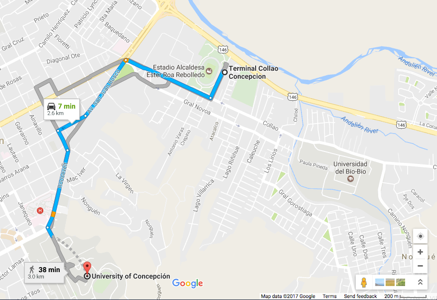
Fig 6: the way to the Universidad de Concepción
campus from Collao main bus terminal. |


